THE AOIS SYSTEM BY PROAMBIENTE
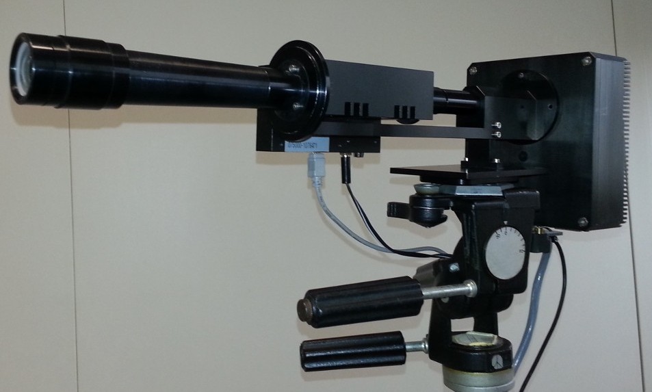
AOIS – Acousto-Optical Imaging Spectrometer is a hyperspectral camera developed by PROAMBIENTE, based on tunable acousto-optic filter technology. The system enables image acquisition across a wide range of wavelengths, with over 200 bands in the visible spectrum and high spectral resolution (< 2 nm).
Designed for both laboratory and field applications, AOIS rapidly acquires monochromatic images that are combined into a hyperspectral cube, where each pixel contains the full spectral signature of the observed scene.
Data are processed using classification, segmentation, and spectral analysis algorithms, enabling the extraction of detailed information on material composition, vegetation stress, and the presence of anomalies. This approach overcomes the limits of traditional sensing systems, providing analysis based on spectral properties rather than shape or color alone.
MAIN APPLICATIONS IN ENVIRONMENTAL MONITORING
Vegetation analysis
Hyperspectral images allow the assessment of plant health, chlorophyll content, photosynthetic activity, and plant stress, through the analysis of spectral variations linked to biochemical properties.
Water quality
Hyperspectral sensors enable the mapping of parameters such as turbidity, algal concentration, and the presence of organic pollutants or metals in surface waters, providing quantitative and spatially detailed information.
Detection of pollutants and contaminants
This technology allows the identification and monitoring of pollutant distribution in soil, vegetation, and surface environments, even when not visible to the naked eye.
Land classification
Spectral signatures make it possible to differentiate and map land cover types (forests, urban areas, water bodies, crops), supporting spatial planning and environmental change monitoring.
Support for environmental management
The integration of hyperspectral data with environmental and climate models provides a quantitative basis for conservation activities, risk mitigation, and sustainable resource management.
Do you want to integrate hyperspectral monitoring into your environmental projects?
Contact us to explore the application of the AOIS system in the field or to design a tailored solution for your needs.